With acknowledgement to Creswick District News and Creswick Museum
| http://www.ozvalveamps.org/temp/1862map.html | Created: 21/01/11 | Last update: 00:03 22/01/11 |
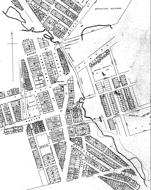
This map shows the works undertaken in 1862 to align the creek behind the Albert St properties, between Water St and Castlemaine Rd.
It also shows the conversion of Sawpit Gully creek (top right) into a drain parallel to Castlemaine Rd which joins the Creswick creek just above the Castlemaine Rd bridge. This creek now crosses Moore St (not shown) as a floodway.
Above and below a few of the meanders remaining by 1862 can be seen, as can anabranches at Northcott Park (bottom) and Calembeen Park (top).
Note: “Bridge St” west of Albert St has been renamed Cushing Ave, Duke St no longer exists, and “Victoria St” east of the creek is actually bushland.
The bow at Water St has since been removed, but it was followed just downstream by a backtrack just like North Pde, and the North Pde backtrack was also preceeded by a bow above Castlemaine Rd just like the one at Water St.
These original bows, backtracks and anabranches reflect the limited fall through the town between Northcott Park and Calembeen Park to drive the creek flow. It is fairly flat and the creek wanders lazily about in its wide floodplain.
This lack of fall or gradient sets a major constraint on moving flood waters through the township.
|
|